Saturday, December 08, 2007

Winter is Here

Well last weekend we got our first major swath of snow for the year. The Cloquet area received about 13" while further north near Two Harbors they received over 18". We decided to get out outside and enjoy it for a day. That is doing anything besides shoveling.......

We traveled north to our property which is located just south of Two Harbors. Sara took this picture of one of the abundant birch tress.


This will hopefully someday be our future building site for our home. If you look real close you can see the steel blue waters of Lake Superior through the trees. Lake view property it is not.
The City of Cloquet plowed the snow into a windrow down the center of main street. They'll come by later and haul it away to a snow dump.

The city's locomotive decorated in Christmas Light for the season. It originally ran for the DM&IR (Duluth, Messabi, & Iron Range) railroad back in the hey day of the Red Ore Iron Mines.

Thursday, December 06, 2007

Thanksgiving in Rogers City


First Snow. Well not exactly, but it was the first that stayed. This was a picture we took along the roadside somewhere on US-2 between Ashland and Ironwood.

The Saturday after Thanksgiving we spent at the Alpena gun club shooting sporting clays. Here Dad takes aim at one of the florescent clay birds flying across the open field. I wish the real things were florescent orange. It'd make them a lot easier to hit..... or at least easier to see.

Sara takes here turn at one of the stations while my sister Wendy, her husband Frank, and Dad watch on. After a drought in the beginning Sara finished strong, clearing 7 of the last 8 clay birds. I better practice a bit more before I take her out again!

UP Bird Camp 2007

We made our annual trek into the backwoods of the Huron Mountains again this year in pursuit of the all elusive upland grouse. Some of us were successful while others were not but regardless everyone had a great time. The following are a few pictures I took back with me. Though they don't taste as good as grouse but they are sure nice to look at......

Dad and his Lab, Kam, take five after we walked several miles on our second day of hunting. (The dog probably ran five times the distance we traveled!)

Kam resting on our third day of hunting.

The Jurmu Camp on our last day in the UP.

A beaver pond reflects the clear blue sky and what remained of the fading fall colors.

Straights of Mackinac

Unfortunately, in early October Sara and I traveled down to the Detroit area for a family funeral. On our way back north we stopped in Mackinac City for a quick break.
The Mackinac Lighthouse and keeper's quarters.

The Mackinac Bridge framed by a trio of birch trees.

Sara and I pose in front of the Bridge from the "troll" side.

Another shot of the Bridge.

Tuesday, October 30, 2007

Minnesota Fall

It seems while we where on vacation in Arizona and Utah, Minnesota began its transition into fall. Below are some fall pictures we collected from late September at or near Jay Cook State Park.

A bush found on the banks of the St. Louis River which is on fire with color.

An abandoned train tressel that spans over the St. Louis River. It now carries a portion of the Munger Trail which connects Duluth to Hinkley about 75 miles to the south.

The reservoir behind the Minnesota Power Dam near Jay Cook. The reservoir was really high at the time of our visit due to several large rainstorms that came through, finally ending our drought.

Another shot of the reservoir capturing the fall colors on its rocky peninsulas and islands.

The St. Louis River carving its way to Lake Superior.

The spillway at the dam.

Saturday, October 20, 2007

The Last Day

The day finally came that we've all been dreading. Our last full day of vacation. Sara and I regrettably had to return to Minnesota while our friends Quent and Christina would stay for several more days.

The morning sun breaking through the overcast clouds over Bryce Canyon.

Morning sun against the walls of Bryce Canyon

The Glen Canyon Dam in Page, AZ. We stopped at the dam for a brief moment and went inside to read about its history. Fascinating stuff for all of us Civil Engineers. Christina was kind enough to humor us for awhile.
The Colorado River as hit heads south from the dam towards the Grand Canyon.

The road to nowhere? Or for Sara and I the road back home. We actually jumped out of the car to get this one.


Another lonely road. The occasional thunderstorm streaked across the horizon. None of us could seem to spot the "phantom" lightning that enamored Quent. We later did see the lightning with our own eyes. It was quite a show.

A large butte that dominated the surrounding sage.

Dark storm clouds above the sunlight terrain.

Standin on the corner in Winslow, AZ. Just as the famous Eagle's song says we were takin' it easy.


Another shot of the infamous corner.

Bryce Canyon

Sunrise from Rainbow Point, located at the far southern edge of the park. This was one of the few mornings where the girls joined us to watch the sunrise. It was also a cold morning too, so the warmth of the morning sun was welcomed by all.

The cliffs and hoodoos of Bryce Canyon stand out in contrast to the pine forest covering the valley below.

The "Natural Bridge" though more accurately categorized as an arch. (Natural bridges must be span over some hydraulic feature, such as a river or stream) This is one of the largest arches in the park.

More of the unique features of Bryce.

We took one of the trails down into Bryce Canyon from Sunset Point. The canyon was even more amazing up close.
More scenic views along the trail.

This was a neat cavern that was formed from decades of erosion.

The pillars seem to guard this corner of the canyon.

This is a section of the Wall Street trail leading out of the canyon. It was reported that this trail was closed at the time of our visit due to a rock slide, however we found it easily navigable.


This is the section of the Wall Street trail that was partial blocked due to the rock slide.


A view at the canyon rim.

Sara and I pose for another photo-op.

Grand Canyon to Bryce Canyon

Our second night at the North Rim we camped at the National Park campground. The following morning after a quick shower we packed up and headed north into Utah. On the road north to Bryce Canyon we saw a roadside sign for Zion National Park. It wasn't on our agenda but it was a place both Sara and I wanted to see. So we took a short side trip into the park. I think our trip into Zion was one of our favorite moments along the trip. It truly was spectacular and we were disappointed we didn't have more time to visit. Someday we'll return.

An island of aspen in a forest of pine. We stumbled across this aspen on our walk back to our campsite after watching the sunrise at the canyon rim.

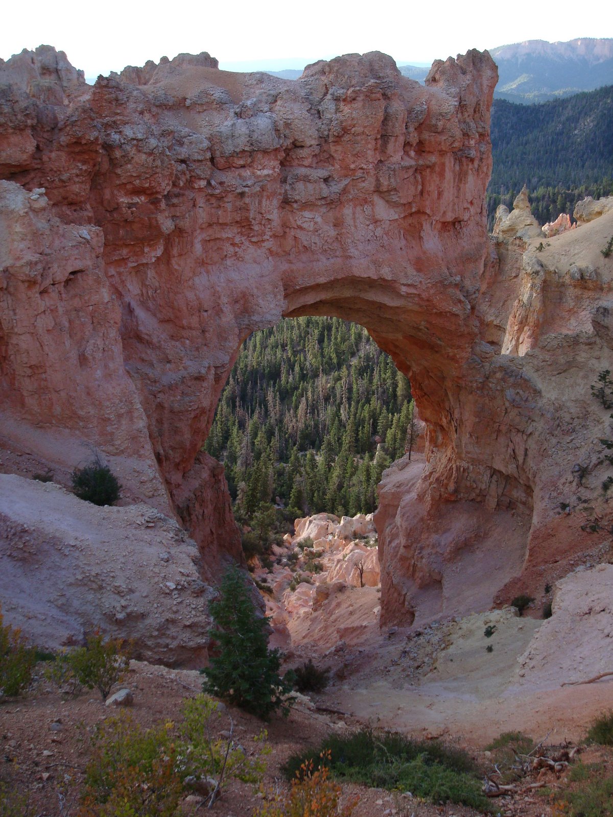
These pictures cannot capture the beauty of the sandstone cliffs that surround the park. Here is a picture of one of the cliffs that towers over the park road.

Sara snapped this picture of me as I take a break from scrambling around on the rocks. I can see now why many consider this place as one of the best kept secrets of the National Park system and also one of the premier mountain biking destinations.

Sara doing her part to prevent erosion. We found this dugout along the Canyon overlook trail in Zion.

A view of Zion Valley from the end of the Canyon Overlook trail. Notice the park road winding down at the base of the valley.

Another view from the Overlook trail.

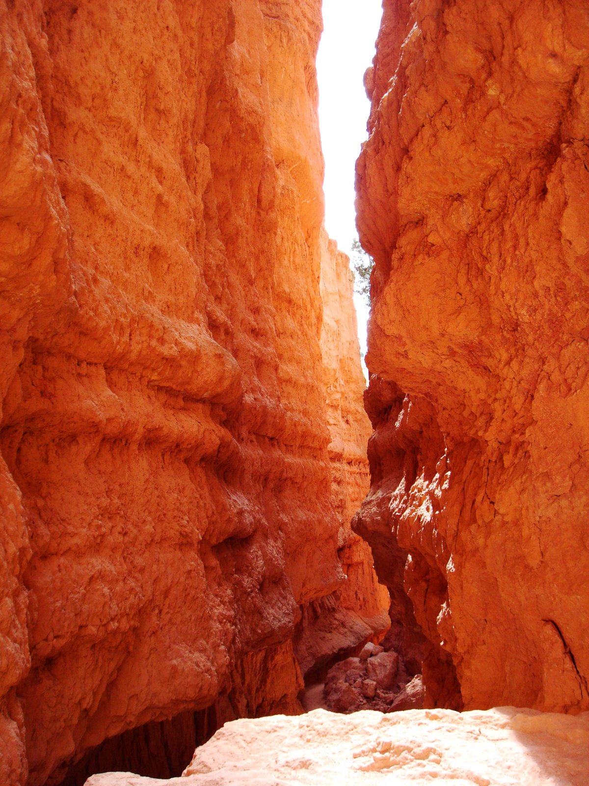
More of the sandstone landscape that make Zion unique.

A checkerboard patern on on one of the large buttes within the park. Sara snapped this picture as we passed by in our car.

A snapshot from Red Canyon on our way to Bryce.


We made it to Bryce Canyon just in time to for sunset. The unique geologic features of Bryce Canyon dominate the foreground with Grand Staircase/Escalante National Monument can be seen beyond.
The sun sets below he Utah horizon and briefly illuminates the smaller limestone hoodoos below us.

Another shot of the glowing hoodoos.
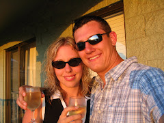
The three amigos.
The last light of day.