Monday, October 15, 2007

North Rim

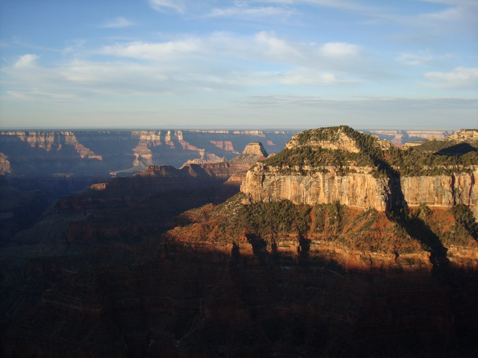
After camping just north of the Park, Quent and I awoke early to view the sunrise over the canyon. This photo doesn't due the experience justice.


The same picture as above except later in the morning.

Mount Hayden in the foreground and the Grand Canyon in the background as viewed from Point Imperial along the North Rim.

Sara posing for a picture at Point Imperial.
A black and white of the cliffs.


A black and white of Mount Hayden bathed in sunlight.


Sara again at Point Imperial. We spent quite a bit of time here as the views warranted our attention.

Painted Desert

The next morning we left the south rim and traveled the loop to the North Rim through the Painted Desert. Most of the day was spent in the car but we occasional stopped to enjoy the scenery.

Morning light from the South Rim.

A view of the Little Colorado River on its way to the Colorado. This photo was taken looking north. Notice the flat plateau that extends to the east.

The ground at one of our spots was dessicated creating the crack pattern seen at the surface here. Our resident geotech engineer identified the soil as expansive silt with a touch of clay. It was quite an odd sensation walking upon it, as it felt spongy and would collapse under our weight.

King of the Mountain. Quent and tore through the barbed wire fence seen here in the foreground and raced to the top of this hill to check out the the view. I say tore because I ripped my shirt on my way through and drew blood on my shoulder on my way back. I haven't yet met a barbed wire fence that has not taken a liking to me or the clothes I'm wearing. These fences however have seemed to show no interest in Quent. They must have become bored with him after his many years on the farm back in Michigan.

An interesting sight along the highway. Years of erosion have exposed the distinct layers of soil along this ridge. Our resident geotech giggled with excitement. The rest of us yawned. Just kidding, we all were impressed.

The beginning of Echo cliffs on the eastern side of the road. This area was basically open desert with these cliffs suddenly rising from the sage.

A view of the Vermilion Cliffs directly ahead of us as we traveled west towards the Colorado River.

The new truss arch bridge spanning over the Colorado River. Its abutments were built directly into the face of the canyon.

The original truss arch bridge is to the right and currently only supports pedestrian traffic.

A view of the Colorado River from the old bridge. The water here is a deep green with milky clouds of sediment flowing beneath the surface. Quite a contrast from its mud brown appearance within the Grand Canyon.

Another view of the Vermilion Cliffs.

A picture of the House Rock Valley. The edge of the Vermilion Cliffs are to the right.

After leaving the House Rock Valley the terrain quickly changed. The road turned south and climbed towards Jacob Lake. A mix of pines and grassy fields dominated the terrain. After making a quick stop in Jacob Lake we continued south to our campsite for the night, located in a National Forest Campground just north the the National Park.

Tuesday, October 02, 2007

Bright Angel Trail II

After spending the night at the Indian Garden's Campsite, we broke camp early the next morning for the final leg of our journey out of the canyon. A warm meal and a hot shower awaited us at the end of the trail.

A view of the south rim from the Bright Angel Trail. For a good part of the morning the trail was covered in shade making what would have otherwise been a very hot climb into a pleasant walk.

A shot to the northwest along the trail. We were blessed with another beautiful day for our final day in the canyon.

A view from where we came. The canyon in the immediate foreground contains Garden Creek along which the Bright Angel Trail follows. This canyon spills into the Colorado river which has formed the portion of the canyon in the east-west direction. The canyon extending northwards beyond the Colorado river contains the Bright Angel Creek. It is within this canyon near where it meets the Colorado that we had camped the night before last.

This picture was taken near the top of the canyon. Almost there! We stopped here for a rest and to capture the shadows of clouds as they dance along the walls of the canyon. Not more than a week after we left a man fell to his death near this spot while trying to take a picture of his family. Christina ever fascinated with the strange way people manage to kill themselves within the canyon ended up buying a book at the park bookstore which provided a chronological description of each death since the park was formed. It was a morbid form of entertainment that strangely we all enjoyed for the remainder of the trip.

After checking into our hotel rooms and taking our long awaited hot showers, we stole out to Powell Point to catch the sunset.

The last sun rays of the day slowly exit the canyon.


A photo-op now that we are somewhat presentable.

A few storms raged off to the west and southwest near dark. Lightning would illuminate the sky on occasion which was spectacular in itself.

Another view of the canyon at dusk.

From left to right: Quent, Christina, and Me. Sara was kind enough to snap the picture.

Monday, October 01, 2007

Bright Angel - Part I

After the long hike down and a short nights rest, our bodies, particularly our muscles, weren't quite ready for the 12 mile hike within the canyon that we had planned for our fourth day. After a brief consultation with the crew over breakfast it was decided the morning would best be spent in leisure, relaxing in the canyon along the Bright Angel Creek. Strangely enough there wasn't much protest from anyone.

Morning light over the Colorado River.

I mistakenly left out my water bladder overnight and as we prepared our breakfast we noticed that we'd missed some visitors. We suspect the tracks were left by a few ringtails we'd spotted the previous night.

Another shot of the Bright Angel Creek near our campsite.

By mid-morning temps were already up in the 80's. We took frequent trips to the creek to cool off.

A few rain showers pass over us in early afternoon as we packed our gear in preparation for our hike on the Bright Angel Trail to Indian Gardens. On our hike out we stopped to take this picture of the Silver Bridge over the Colorado River as the storm clouds receded in the background.

We spotted this little guy alongside the trail.

More storm clouds approached us as we hiked, shading us from the mid-afternoon sun.

The largest storm of the day passed to our west as we ascended the canyon. While we remained dry, it did dumped a lot of rain in other portions of the canyon. Best of all it brought out this rainbow for our viewing pleasure.

Mammatus clouds that formed on the tail end of the storm.
As we neared Indian Gardens we came across this waterfall along the Bright Angel Creek.


Quent catches up along the Bright Angel Trail after wandering off with the camera once again.

The setting sun light off of the North Rim from our campsite at Indian Gardens.

Saturday, September 29, 2007

South Kaibab Trail

We awoke early on the morning of the third day of our trip to begin our hike down the South Kaibab trail. The trail is only six miles long however it descends over 5000 feet down to the Colorado River. We started at dawn and arrived at the Colorado in the early afternoon. We took plenty of pictures as you can see below.


The view near the start of the trail looking towards the northwest. The morning sun had just begun to strike the upper portions of the canyon as we began our decent. I tried to enjoy the view as Sara mumbled behind me something about having to wake up at the butt-crack of dawn. I like to think of it as her way of thanking me for getting her up in time to see the sun rise.

The troops as they descent. Pictured first is me with my pack and a breakfast of bagels hanging off my pack in a plastic bag. Christina is directly in front of me while Quent leads the way. Steady as we go. No one wanted to accidentially take the short cut down over the edge to our right.

Quent and Christina pictured as they followed the trail down. The first part of the trial was mostly switchbacks carved out along the face of the canyon wall. This allowed for a scenic yet shaded path for a good part of the morning.

A view of O'Neill Butte below. The sun is starting to encroach on the depths of the canyon below.

A quick stop to put on our war paint for the impending battle with the sun. Us folks from Minnesota and especially our friends from Wrangell, AK aren't use to the blazing Arizona heat.

A black and white of the canyon below us. Smoke the from forest fire along the north rim fills the canyon to the east. The plateau shown below is about 2000 feet further down. The Colorado River is an additional 1500 feet below that.

Another view of the O'Neill Butte from the trail. How much further?

A view of the trail as is disappears behind the rock in the foreground and snakes around the butte and into the canyon in the background.

Sara and I stop for a photo opp. We are both about 3 inches shorter in this picture after having our spines compressed from our backpacks. We welcome the break from packs about as much as we were enjoying the view.

Looking back along the trail we had just come. The South Rim dominates the background which reminds us we are only about half way into the canyon. This section of the trail was much less aggressive the the first portion as it leveled out as we neared the plateau.

A view of the canyon as we neared Skeleton Point. Aptly named as temperatures were soaring above 100 degrees at this point. Still another 2000 vertical feet to go. Quent and I started to overhear rumors of mutiny at this point.

One of the first glimpses of the Colorado river since leaving the south rim. We were somewhat surprised to see how much sediment was being carried by the river. This view reminded me of a quote I'd read earlier from a 19th century explorer of the Colorado. "Too thick to drink and too thin to plow" - Major John W. Powell, 1869. That may be so, but at this portion of the trip any ribbon of water was looking awfully inviting.

We ended up skipping the Colorado and headed straight for tributary stream. This is called the Bright Angel creek or heaven as we were calling it that day. Quent immediately shed his pack and jumped into the cool water. The rest of us sat in the shade as we tried to muster the energy to walk the last 50 yards to the creek. It didn't take long before we were all soon in the river trying to escape the 107+ heat.

Our campsite along the Bright Angel Creek.


An early evening view of the Bright Angel Canyon.

The setting sunlight on the walls of the Grand Canyon.

Sara, Quent, and Christina smile for the camera near the Colorado River.