As we continued south along the Richardson from Glenallen, we had spectacular views of the Wrangell Mountains of Wrangell-St. Elias Park that peeked out through the clouds.
The guys couldn't pass up a chance to fish at a creek along the Richardson Highway. This photo is nice, but doesn't tell the story of getting to the creek - hiking through chest high weeds & windfall, then sliding down the side of a mini-cliff in the rain. Ok, you're right - can't complain.
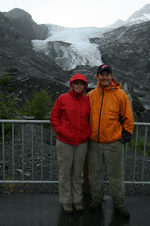
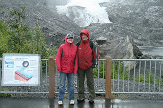
About 30 miles north of Valdez, we were stopped at your 'typical' roadside park along the Richardson Highway - an overlook of the Worthington Glacier.
Looking over the railing, we saw a trail leading to the edge of the glacier. Sara was particularly excited at the opportunity to stand at the edge of a piece of geology in action.
The glacier blue color was amazing. The photos don't do it justice.
We continued south through Keystone Canyon, through which the Lowe River flows (huh, think there are a couple juxtaposed letters in the river name). Apparently, railroad companies literally got into gunfights to secure this passage to the copper country north of Valdez.
Just before reaching Valdez, we were treated to two waterfalls in Keystone Canyon, Horsetail Falls and Bridal Veil Falls.


No comments:
Post a Comment